Product successfully added to your shopping cart
There are 0 items in your cart. There is 1 item in your cart.
Africa
- Africa
- Angola
- Biafra
- Burundi
- Central African States
- Comoros
- Congo Democratic Republic
- Eritrea
- French West Africa
- Gambia
- Ghana
- Guinea
- Guinea-Bissau
- Kenya
- Lesotho
- Liberia
- Libya
- Madagascar
- Malawi
- Mauritius
- Mozambique
- Nigeria
- Rhodesia
- Rwanda
- Seychelles
- Sierra Leone
- Somalia
- South Africa
- South Sudan
- Saint Thomas & Prince
- Swaziland
- Tanzania
- Tunisia
- Uganda
- West African States
- Zaire
- Zambia
- Zimbabwe
- Asia & Middle East
- Afghanistan
- Bahrain
- Bangladesh
- Brunei
- Burma
- Cambodia
- Ceylon
- China
- Egypt
- French Indo-China
- Hong Kong
- India
- Indonesia
- Iraq
- Japan
- Jordan
- Kazakhstan
- Korea
- Kyrgyzstan
- Laos
- Lebanon
- Malaya
- Malaysia
- Mongolia
- Myanmar
- Nepal
- Oman
- Pakistan
- Philippines
- Singapore
- South Vietnam
- Sri Lanka
- Tajikistan
- Thailand
- Turkmenistan
- Uzbekistan
- Vietnam
- Yemen
- Australia & Oceania
- Europe
- South & Central America
- Sets
- Special
- Wholesale
- Pre-1961
- Other
Filter
Africa
Angola
Angola is a country in Southern Africa. It has an area of 1,246,700 sq. km (481,354 sq. mi.) and is the seventh largest country in Africa. Angola has a population of about 24 million people.
Biafra
Biafra was a secessionist state in south-eastern Nigeria that existed from 30 May 1967 to 15 January 1970. In 1967, it had an area of 77,306 sq. km (29,848 sq. mi.) and had a population of about 13.5 million people.
Burundi
Burundi is a country located in Southeast Africa, bordered by Rwanda to the North. It has an area of 27,834 sq. km (10,745 sq. mi.) and has a population of about 10.4 million people.
Central African States
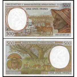
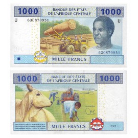
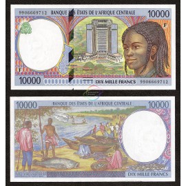
The Bank of Central African States was established in 1972. It is a central bank that serves the Economic and Monetary Community of Central Africa which consists of Cameroon, the Central African Republic, Chad, Equatorial Guinea, Gabon, and the Congo Republic.
Comoros
Comoros is an independent state comprising three of the islands of the Comorian archipelago in the Indian Ocean, off the coast of East Africa. It has an area of 1,862 sq. km (719 sq. mi.) which makes it the third smallest African nation. Comoros has a population of about 798,000 people.
Congo Democratic Republic
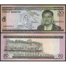
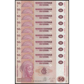
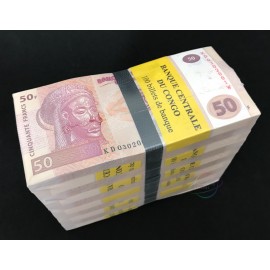
The Congo Democratic Republic is a country located in Central Africa. It was formerly known as Zaire from 1965-1997. The Congo Democratic Republic has an area of 2,345,409 sq. km (905,355 sq. mi.) which makes it the second largest country in Africa after Algeria. It has a population of about 77.4 million people.
Eritrea
Eritrea, officially the State of Eritrea, is a country in the Horn of Africa. With its capital at Asmara, it is bordered by Sudan in the west, Ethiopia in the south, and Djibouti in the southeast. The northeastern and eastern parts of Eritrea have an extensive coastline along the Red Sea. The nation has a total area of approximately 117,600 km2 (45,406 sq mi).
French West Africa
French West Africa was a federation of eight French colonial territories in West Africa, existing from 1895 to 1960. It covered a land area of about 4.7 million square kilometers and had a population of over 20 million people by the mid-20th century. The federation included modern-day countries such as Senegal, Mali, Ivory Coast, and Burkina Faso, with Dakar as its capital. It played a significant role in France’s colonial empire and issued its own currency and banknotes during its existence.
Gambia
Gambia is a country in West Africa that is entirely surrounded by Senegal except for its coastline on the Atlantic Ocean at its western end. It is the smallest country in mainland Africa. Gambia has an area of 10,689 square kilometres (4,127 sq mi) and a population of 1,882,450.
Ghana
Ghana is situated on the coast of the Gulf of Guinea. It has an area of 238,535 sq. km (92,099 sq. mi.) and has a population of approximately 27 million people.
Guinea
Guinea, formerly known as French Guinea, is a country on the West coast of Africa. Guinea has a population of 10.5 million and an area of 245,860 square kilometres (94,927 sq mi). Guinea is a republic. The president is directly elected by the people and is head of state and head of government. The unicameral Guinean National Assembly is the legislative body of the country, and its members are also directly elected by the people.
Guinea-Bissau
Guinea-Bissau is a small country on the west coast of Africa, bordered by Senegal, Guinea, and the Atlantic Ocean. Known for its diverse ecosystems, including mangrove forests and the Bijagós Archipelago, it has a rich mix of cultures and traditions. Guinea-Bissau covers a land area of approximately 36,125 square kilometers (13,948 square miles) and has a population of around 2.2 million people as of 2024. The capital city is Bissau, which serves as the administrative and economic center of the country.
Kenya
Kenya is a country in East Africa famous for its scenic landscapes and vast wildlife reserves. It has an area of 581,309 sq. km (224,080 sq. mi.) and has a population of about 45 million people.
Lesotho
Lesotho is a landlocked country completely surrounded by South Africa. It has an area of 30,355 sq. km (12,727 sq. mi.) and has a population of about 2 million people.
Liberia
Liberia, officially the Republic of Liberia, is a country on the West African coast. Liberia means "Land of the Free" in Latin. It is bordered by Sierra Leone to its west, Guinea to its north and Ivory Coast to its east. It covers an area of 111,369 square kilometres (43,000 sq mi) and has a population of 4,503,000 people.
Libya
Libya is a country in the Maghreb region of North Africa, bordered by the Mediterranean Sea to the north, Egypt to the east, Sudan to the southeast, Chad and Niger to the south, and Algeria and Tunisia to the west. With an area of almost 1.8 million square kilometres (700,000 sq mi), Libya is the fourth largest country in Africa, and is the 16th largest country in the world.[8] Libya has the 10th-largest proven oil reserves of any country in the world.
Madagascar
Madagascar is an island country in the Indian Ocean, off the South-eastern coast of Africa. It has an area of 587,041 sq. km (226,597 sq. mi.) and has a population of about 22 million people.
Malawi
Malawi is a landlocked country in southeast Africa that was formerly known as Nyasaland. It is bordered by Zambia to the northwest, Tanzania to the northeast, and Mozambique on the east, south and west. Malawi is over 118,000 km2 (45,560 sq mi) with an estimated population of 16,777,547 (July 2013 est.)
Mauritius
Mauritius is an island nation in the Indian Ocean about 2,000 kilometres (1,200 mi) off the southeast coast of the African continent. The country includes the islands of Mauritius and Rodrigues, and the outer islands (Agaléga, St. Brandon and two disputed territories). The area of the country is 2,040 sq. km. The capital and largest city is Port Louis. Mauritius was a British colonial possession from 1810 to 1968, the year of its independence.
Mozambique
Mozambique is a scenic country in South-East Africa. Mozambique is rich in natural resources, is biologically and culturally diverse, and has a tropical climate. It has an area of 801,590 sq. km (309,496 sq. mi.) and has a population of about 24 million people.
Nigeria
Nigeria is a federal republic in West Africa, bordering Benin in the west, Chad and Cameroon in the east, and Niger in the north. Its coast in the south lies on the Gulf of Guinea in the Atlantic Ocean. With approximately 184 million inhabitants, Nigeria is the most populous country in Africa and the seventh most populous country in the world. As of 2015, Nigeria is the world's 20th largest economy, worth more than $500 billion and $1 trillion in terms of nominal GDP and purchasing power parity respectively. It is the second-largest economy in Africa, after South Africa.
Rhodesia
Officially the Republic of Rhodesia from 1970 to 1979, it is now divided into Zimbabwe in the south and Zambia in the north. It had an area of 390,580 sq. km (150,804 sq. mi.) and had a population of about 6.9 million people in 1978.
Rwanda
Rwanda is a sovereign state in central and east Africa. It is a geographically small country with one of the highest population densities in sub-Saharan Africa. Rwanda has an area of 26,338 sq. km (10,169 sq. mi.) and a population of about 12 million people.
Seychelles
Seychelles is an island country located in the Indian Ocean, northeast of Madagascar and off the eastern coast of Africa. It is known for its stunning white-sand beaches, clear turquoise waters, lush tropical forests, and unique biodiversity. The country consists of 115 islands, with the largest and most populous being Mahé. Seychelles covers a land area of approximately 459 square kilometers (177 square miles) and has a population of around 100,000 people as of 2024. The capital city is Victoria, located on Mahé Island, serving as the political, economic, and cultural center of the country.
Sierra Leone
Sierra Leone is a country on the southwest coast of West Africa. It is bordered by Liberia to the southeast and Guinea to the northeast. Sierra Leone has a tropical climate with a diverse environment ranging from savanna to rainforests, a total area of 71,740 sq km (27,699 sq mi) and a population of 7,092,113 as of the 2015 census. The capital and largest city is Freetown.
Somalia
Somalia is a country located in the Horn of Africa. It is bordered by Ethiopia to the west, Djibouti to the northwest, the Gulf of Aden to the north, the Indian Ocean to the east, and Kenya to the southwest. Somalia has the longest coastline on Africa's mainland, and its terrain consists mainly of plateaus, plains and highlands. Somalia has an estimated population of around 16.3 million.
South Africa
South Africa is the southernmost country in the African continent. It has an area of 1,221,037 sq. km (471,443 sq. mi.) and a population of about 54 million people, which makes it the world's 25th most populous nation.
South Sudan
South Sudan is located in north-east Africa. It gained its independence from Sudan in 2011. South Sudan has an area of 619,745 sq. km (239,285 sq. mi.) and has a population of about 8.2 million people.
Saint Thomas & Prince
The Democratic Republic of São Tomé and Príncipe, is an island nation in the Gulf of Guinea. It has an area of only 1,001 sq. km (386 sq. mi.) and a population of 192,993. São Tomé and Príncipe is the second-smallest African country, behind Seychelles.
Swaziland
Eswatini, formerly known as Swaziland, is a small, landlocked country in southern Africa, bordered by South Africa and Mozambique. Known for its rich cultural traditions, wildlife reserves, and mountainous landscapes, Eswatini is one of the few remaining absolute monarchies in the world. It covers a land area of approximately 17,364 square kilometers (6,704 square miles) and has a population of around 1.2 million people as of 2024. The country has two capitals: Mbabane (administrative) and Lobamba (royal and legislative).
Tanzania
Tanzania is a country in East Africa. Africa's highest mountain, Kilimanjaro, is located in north-east Tanzania. Tanzania has an area of 947,303 sq. km (365,756 sq. mi.) and has a population of about 47.4 million people.
Tunisia
Tunisia is located in North Africa. It has an area of 163,610 sq. km (63,170 sq. mi.) and has a population of about 11 million people.
Uganda
Uganda is a country located in East Africa. It has an area of 241,038 sq. km (93,065 sq. mi.) and has a population of about 37.8 million people.
West African States
The West African States are located on the northwest coast of Africa and consists of Benin, Mali, Senegal, Burkina Faso, Ivory Coast, Togo, Niger, and Guinea-Bissau.
Zaire
The Republic of Zaire was a Central African State from 1971-1997. It is now known as the Democratic Republic of Congo and has an area of 2,345,410 sq. km (905,568 sq. mi.) and a population of about 46 million people.
Zambia
The Republic of Zambia is a landlocked country located in Southern Africa. It has an area of 752,618 sq. km (290,587 sq. mi.) and has a population of about 14 million people.
Zimbabwe
The Republic of Zimbabwe is a landlocked country located in Southern Africa. It was formerly known as Southern Rhodesia (1911–64), Rhodesia (1964–79), (1979–80) Zimbabwe Rhodesia. Zimbabwe has an area of 390,757 sq. km (150,871 sq. mi.) and has a population of about 13 million people.
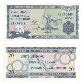
Burundi 20 Francs, 1973, P-21b, UNC
Features a traditional Burundian dancer on the front, with inscriptions in French and Kirundi. The reverse displays intricate guilloche patterns. Measuring 130 × 64 mm, the note is printed in blue with multicolored underprints. It includes the signatures of the President and Administrator of the Bank of the Republic of Burundi.$64.99In Stock


